
Pride in protecting and mapping Biigtigong Nishnaabeg
By Kelly Anne Smith
NORTH BAY— Visualizing strong cultural activity on maps of the traditional territory of Biigtigong Nishnaabeg has brought proud moments for those connected and reconnecting to the land.
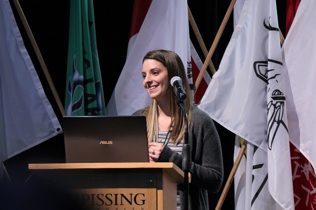
The progression and importance of the Biigtigong Nishnaabeg Mapping Projects and Story Vault project was shared as part of the Anishinabek Nation’s Lands, Resources and Economic Development Forum, Kina-Gego-Naabadosin – Everything is Connected, held at Nipissing University from Oct. 22-24.
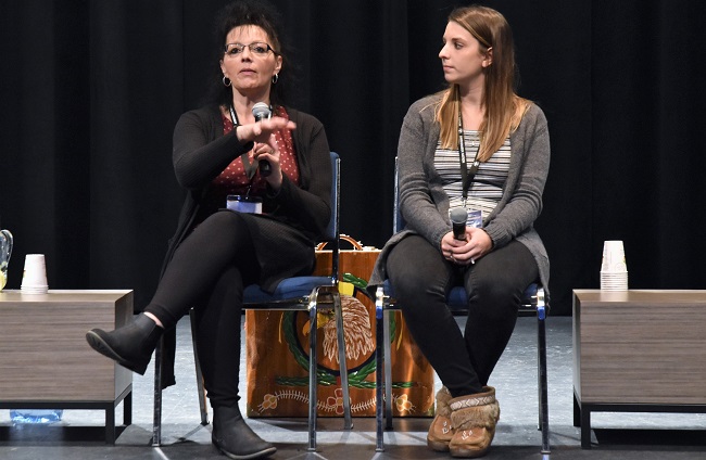
Biigtigong Nishnaabeg’s Environmental Coordinator Brittany Moses, who is involved with the protection of the lands and resources, and Florinda Christianson, Manager of Culture, Heritage and Tourism, gave a presentation then returned for a Breakout Session.
Moses deals with consultation on aerial spraying, forestry, exploration, traplines, pipelines, water protection zones, and mapping out cultural sites.
“We are making sure we can find that balance between industry and protection. It always helps to have those maps. If there is an area in question, say in the water protection zone, we might not say that activity can’t happen in an area. We might ask what measures will be taken to ensure protection,” explains Moses. “If work needs to happen near a community member’s cabin, can we put conditions on that permit where our members can use that cabin specifically for fall hunting? We can say we don’t want any activity happening within a time period.”
In the workshop, a woman asked about sharing resource locations.
“We are struggling with the misuse of information that is put out to our Nation as far as medicinal plants. We are in fear that if we publish these areas, someone could go take all the sweetgrass and then it wouldn’t be able to be harvested again.”
This concern was not unfamiliar according to Moses.
“There is a bit of fear for us too, putting information out there,” notes Moses. “Certainly, we
could replant if medicines are over-harvested.”
She explains that there are external maps and internal maps.
“The internal maps have more information so the Chief and Council can be shown maps when there are questions. On cultural sites, they might say no activity should happen in certain areas.”
Moses says consideration is decided case-by-case.
“Conditions might be different for a forestry company versus a mining company. We are activity specific.”
Gathering the data has been helping to build connections and relationships with the Elders and the youth says Florinda Christianson.
“We put up community cabins on our western territory which gave people access to that land. It brings people back and reconnect to their land,” explains Christianson. “We had an Elder and youth gathering there. We were striving to get our Elders back out on the land. Once you are in that place, those stories start to come out, ‘Oh, I remember coming here with my Nmishomis and I remember picking berries.’ We paired Elders with youth and heard of new friendships. It gave them the opportunity to get to know each other on personal levels.”
The community is excited about the project that measures the activity in the area.
Moses says values mapping is helping in everyday decision-making.
“We want to make sure our community is going to be able to continuously use the land. If we are not protecting those values then they can be destroyed by industry in a blink of an eye.”
Moses explains cultural values need protecting on-reserve and in traditional territory.
“It might be a tent or cabin site, or where people go harvesting for medicinal plants or berries. All those need to be protected,” states Moses. “All our work goes hand in hand because [Florinda] is collecting that data in order for me to protect them.”
Christianson is gathering oral stories, travel route mapping, kill sites, and oral histories. She says cultural history will strengthen the education system.
“All the history I gather is going to be implemented into the school. Instead of having the textbooks, they are actually going to hear stories about their Nmishomis and their Nokomis out on the land. They can relate to that. That will enhance their education. I’m excited we will be playing a major role in that as these stories start to evolve. We can start gathering it and bring it in to the school in a classroom setting.”
Christianson says Biigtigong Nishnaabeg has land-based learning from Kindergarten to Grade 8.
“We do a moose camp that involves all the students. We do a fish harvest and land-based activities but it’s not just the school. Other departments participate to ensure these students are gathering that knowledge,” explains Christianson. “They have done projects on tikanogan making. They’ve brought snowshoes in. The kids get a first-hand participation to do all these things. The stories come with the participation. How it was. How it was created. Why it was done.”
Christianson adds that cultural learning will also see a boost in the digital capacity.
“Biigtigong is also working on an online dictionary. Our students are learning more about their language. It’s implemented in the school. It’s slowly coming back.”
The informative maps have been awe-inspiring. One man exclaimed to Christianson, “Wow, I went everywhere in our territory… The final map gave the community a sense of pride. It shows how much we are out on our territory.”